
Differential Global Positioning Systems Survey
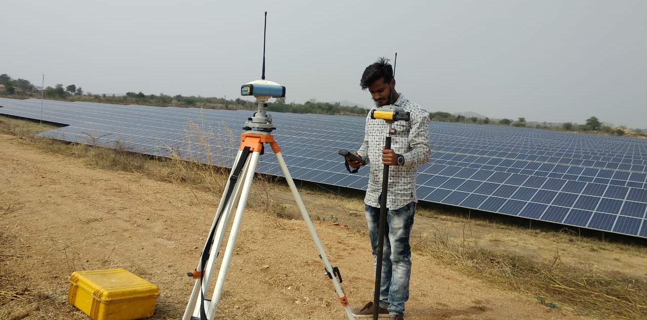
DGPS Survey achieves higher positional accuracy by making use of the differential capabilities of two GPS antennas linked by a radio signal. We use latest and efficient differential GPS equipment or DGPS instrument for DGPS survey procedure.
We Deccan Survey Solutions can provide all facets of Advanced land surveying services for your commercial or residential needs. From the monumentation of a single property corner, to providing comprehensive site conditions surveys for large commercial and industrial properties, we are here to help.
Our land surveying department and the land surveyors are highly efficient, and are capable of carrying out any survey that employs modern equipment and latest technologies. We always implement the best practices to provide the most accurate and precise data to our clients. Our land surveyors can make you understand the latest technologies that we use to proficiently monitor and evaluate the project.
DGPS SERVICES
- Real time data,
- Worldwide coverage,
- Not affected by cloud cover, & Higher accuracy.
- 3D survey results,
- 24 hours availability,
DGPS WORKING METHODOLOGY
- Distance from minimum 4 satellites determines position.
- Signal travel time from satellite to antenna determines the distance
- Calculation by base station is difference between the specified coordinates of its location and those indicated by the satellites,
- This difference continuously broadcasts a signal to the DGPS receiver or rover by the station,
- This same difference accurately determines its location by the rover
DGPS Applications:
- Azimuth determination,
- Collar pick-ups (X;Y;Z)
- Control establishment and densification,
- Topographic surveys,
- Positions, lines and levels setting-out.
SURVEYING SERVICES
- Boundary Surveying
- Topographic Surveying
- Construction Site Surveying & Layout
- Land Planning and Consulting
- Geographic Information Systems / Mapping
- Residential Subdivisions
- Commercial Subdivisions
- Global Positioning System
- Land Title Surveying
- Computer Aided Drafting & Design
- Legal Descriptions
- Right of Way Map / Land Title Map Development
- Route Studies
- Aerial Photography Control
- Project Control
- Design Surveying
- Residential Subdivisions
- Schematic Design
- Rural Subdivisions